Protected Areas GIS
The Protected Areas GIS collection, available from the NOAA Coastal Services Center, consists of a collection of data, assembled in a common projection (UTM, zone appropriate to each area), covering National Estuarine Research Reserves (NERR) and National Marine Sanctuaries (NMS). Data are released on CD-ROM by reserve or, in some cases, by state.
NOTE: The PAGIS Program is no longer active at the NOAA Coastal Services Center. This webpage is remaining online to document the PAGIS data that are part of NC State University Libraries' data collection.
Data Layers
Shapefiles - Reserve boundaries are available as shapefiles.
MrSID Images:
TIFF Images:
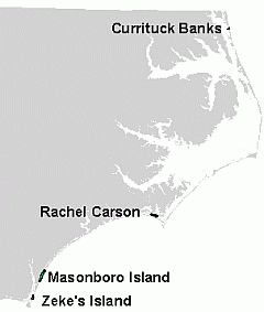
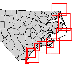
For North Carolina, PAGIS contains Digital Nautical Charts for the entire coast (mostly at 1:80,000 scale), for locations indicated below:
Availability
PAGIS data are available for 25 reserve sites in the U.S. NC State University Libraries owns the CD-ROMs for all of the sites on the southeastern U.S. coast from Virginia to Florida. See Catalog Records for call numbers. These sites are:
- Chesapeake Bay, Virginia
- North Carolina
- ACE Basin, South Carolina
- North Inlet/Winyah Bay,S.Carolina
- Sapelo Island, Georgia
- Apalachicola Bay, Florida
- Guana-Tolomato-Matanzas, Florida (not currently available)
- Rookery Bay, Florida