National Land Cover Database (NLCD)
Note: Other land cover data options are listed on the Land Use/Land Cover Data webpage.
The original National Land Cover Database (NLCD) was created in 1992 by the Multi-Resolution Land Characteristics (MRLC) Consortium. The latest data were released in June 2021, and contain updated versions for years 2001, 2004, 2006, 2008, 2011, 2013, 2016, and new data for 2019. Related data for percent impervious and tree canopy are available for the entire US. For the western US, Ecological Potential and Rangeland are available.

Highlights
- Nationwide coverage, including Alaska, Hawaii, and Puerto Rico.
- 30 meter raster, with cells classified into one of 21 land cover classes. See Legend.
- With the 2016 release, the intended snapshot interval is 2-3 years, beginning with 2001.
- Landsat Thematic Mapper satellite data are used as the base imagery for the classification.
- NLCD data are public domain, and may be freely downloaded from the MRLC website. A version for North Carolina that has been clipped and re-projected is available from links below.
- Much more thorough documentation and information are available on the MRLC website.
- The MRLC site includes a download tool for selecting smaller areas to download by drawing a bounding box.
- One very informative geoprocess which you can do with this data is to use the Tabulate Area tool within ArcGIS software to calculate the total estimated areas of various land cover classes within a polygon (ie. county, watershed, research study area).
Products
The NLCD contains the following data products (as of the June 2021 release):
Landcover for years 2001, 2004, 2006, 2008, 2011, 2013, 2016, 2019. Also a Change Index "... provides a simple and comprehensive way to visualize change from all 7 dates of land cover in a single layer."*
Urban Imperviousness and impervious descriptor products match each date of land cover. Imperviousness data "... represent urban impervious surfaces as a percentage of developed surface over every 30-meter pixel." Additionally, an impervious surface descriptor layer "... identifies types of roads, core urban areas, and energy production sites for each impervious pixel to allow deeper analysis of developed features."
Tree Canopy Cover (TCC) for years 2011 and 2016. TCC data "... contain percent tree canopy estimates, as a continuous variable, for each pixel across all land covers and types and are generated by the United States Forest Service." There are Canopy Analytical and Canopy Cartographic rasters. "The TCC 2011 dataset has two layers: percent tree canopy cover and standard error. For the percent tree canopy cover layer, the pixel values range from 0 to 100 percent and represent the percent of the ground covered by a vertical projection of tree canopies. For the standard error layer, the pixel values range from 0 to 45 percent. The standard error represents the model uncertainty associated with the corresponding pixel in the tree canopy cover layer." "The TCC cartographic product consists of a single layer, percent tree canopy cover and is intended for use as display imagery for backdrop purposes. The pixel values range from 0 to 100 percent and represent the percent of the ground covered by a vertical projection of tree canopies."
Schrubland (Note: Only created for Western US areas) Data "... characterize the percentage of each 30-meter pixel in the Western United States covered by shrub, herbaceous, bare ground, litter, sagebrush, big sagebrush and annual herbaceous, along with estimating shrub height and sagebrush height."
* All quoted statements are from the MRLC website or the product metadata.
Public Access
These links are for North Carolina extracted and re-projected (to NC Stateplane meters) versions, as shown in the graphic at the top of this page.:
- Land Cover, 2019 only - Google Drive download (43 MB)
- Land Cover and Change Index grids, 2001-2019 - Google Drive download (355 MB)
- Impervious and Impervious Descriptor grids, 2001-2019 - Google Drive download (348 MB)
All MRLC data products for the entire US may be freely downloaded or streamed using web services. See https://www.mrlc.gov/data for download options, and https://www.mrlc.gov/data-services-page for WMS streaming links.
NCSU Data Access
A North Carolina version of just the 2019 Land Cover data has been extracted and available for download on the Geodata Server at https://gisdata.lib.ncsu.edu/fedgov/mrlc/nlcd2019 with accompanying metadata, readme files, and layer style files. A single zip file named NC_NLCD2019only.zip contains all the data.
Superseded Versions
Previous NLCD land cover versions for 2001, 2006, 2011, and 2016 that are now superseded by the 2019 release, are available from the Geodata Server under the path /fedgov/mrlc/superseded. These data will likely be removed in a few years.
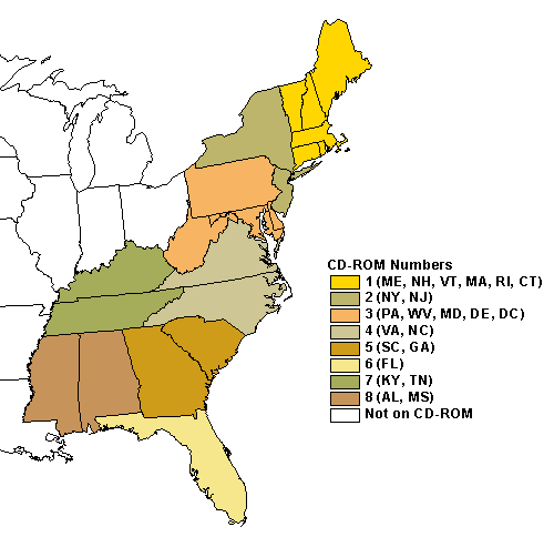
1992 Eastern U.S.
1992 data for other eastern U.S. states is available on CD-ROM (G3701 .A4 1992 .G46) in the GIS Cabinet, D. H. Hill Jr. Reference Area. Data can also be made available upon request to Data Services. The following image shows data organization by CD-ROM: