Finding Digital Flood Insurance Rate Maps (DFIRMs) for NC
The most current North Carolina Digital Flood Insurance Rate Maps (DFIRMs) may be downloaded from the NC Floodplain Mapping Information System(This link is broken. We're working on fixing it) (NC FMIS). For a full discussion about flood data and maps for North Carolina, see NC State University Libraries FEMA Flood Data website.
DFIRMs are flood maps in PDF format. They may be downloaded from the NC FMIS website by selecting the county and map panel number you need. Index maps have been created and are available below to assist in determining which map panel(s) cover your area of interest.
Index Map Instructions
- Open the NC Floodplain Mapping Information System(This link is broken. We're working on fixing it) (FMIS) website in a new window.
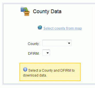
- On the FMIS website, select your county of interest from the drop-down list. You will then see a section labeled "DFIRM Data:" and a drop-down list of DFIRM panel numbers that looks like this image:
- Select an index map from the drop-down below to determine which DFIRM map panel number you need for your area of interest. You'll then choose this map panel number from the FMIS website "DFIRM Data:" drop-down.
Index maps were created by NC State University Libraries staff (JE) using ArcMapbook.
Google Earth KML/KMZ File
The NC Geodetic Survey has created and provided a KMZ (compressed KML) file of the index grid which can be viewed in Google Earth.